Monday, 20 December 2010

Tenerife to Lanzarote

DAY 4, LEG 18 - Tenerife to Lanzarote

This leg took me from Tenerife to Lanzarote, the most northern of the Canary Islands where I would stop before heading into Morocco for the last leg of my African journey.  I decided to do something a little different for this leg and perform a touch and go at each of the 9 airports on the Canary Islands.


Waiting for an Air Berlin aircraft from Zurich to clear runway 26 at Tenerife South.  There is a 25 knot headwind on this runway now and the Beech's rotation speed is around 100kts so it's likely to be a quick take off roll.

Positioning for final approach to La Gomera.

Climbing out of La Gomera following the first touch and go.

Final approach at El Hierro.

Approaching the island of La Palma

Positioning on final for La Palma.  The tower is reporting the wind as 17 knots gusting up to 26!  The direction of the wind was from over the island so this is going to be a bumpy one!

Climbing away from the airport over the port of Santa Cruz.

Leaving the island of La Palma behind us.

Mount Teide on Tenerife already visible 77 miles ahead of us whilst climbing out of La Palma.

Routing past La Gomera again and just visible is the west coast of Tenerife.

Descending into Tenerife North.

Just completed a touch and go at Tenerife North.

Final approach to Las Palmas with a Pintadera ATR 72 just lifted off from runway 21R heading for La Palma and a Thomas Cook B757 rolling for departure to East Midlands, UK.

Final approach to El Berriel on Gran Canaria.  El Berriel is a general aviation airport serving the island and is located a few miles south of the main international airport.

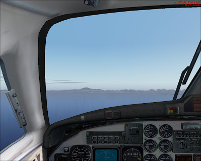
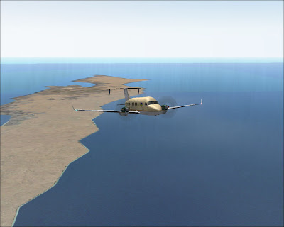
Descent into Fuerteventura with the southern tip of the island in view behind us.

Turning base for runway 19.

Final approach to Fuerteventura.  The name translated from Spanish means "strong wind" which is no surprise given I am trying to land in a 15kt crosswind!

Approach to my final destination of the day, Arrecife airport on the island of Lanzarote.

Parked at Lanzarote.

GCTS - GCRR stats

Take off time:   1322
Landing time:    1522
Flight time:       02:00
Fuel used:         869kgs / 1912lbs

Sunday, 12 December 2010

Progress report

Summary so far...


Legs:             17
Total time:    33:44
Total dist:      9713nm
Fuel used:      14600kgs / 32120lbs

Nouadhibou to Tenerife

DAY 4, LEG 17 - Nouadhibou to Tenerife

The next leg takes me from one of the most remote towns in Africa to one of the most popular tourist hotspots in Europe, one of the volcanic group of Canary Islands.  Technically, the Canary Islands are not part of Europe, but belong to Spain and use the Euro as currency.  We have not left Africa for good, as we will stop in Morocco en route to Gibraltar, our first continental-european stop of the trip.

Climbing out of Nouadhibou looking west into Western Sahara.  A small settlement is visible near the bottom of the window.  There is only one town on the western side of the peninsula, the Western Saharan fishing village of Lagouira which is further south of our location.

Looking back at the peninsula - Mauritania on the left, Western Sahara on the right.

As we start our descent into Tenerife South, Mount Teide which forms the island of Tenerife is clearly visible on the horizon.  The volcano is 12,198ft tall and the third largest volcano in the world (after 2 in Hawaii).

On a long right base for runway 08 at Tenerife South.

Final approach to GCTS.  Visible is the tourist resort of Playa de las Americas on the south-west coastline of Tenerife.  The ground rises rapidly inland towards the peak of Mount Teide.

Parked at Tenerife with a Transavia 737-800 about to push back for departure to the Netherlands.

GQPP - GCTS stats

Take off time:    1058
Landing time:     1246
Flight time:        01:48
Fuel used:           749kgs / 1648lbs

Dakar to Nouadhibou

DAY 4, LEG 16 - Dakar to Nouadhibou

After a quick fuel stop in Dakar I headed north to the sparsely populated country of Mauritania in West Africa.  My stop was to be in Nouadhibou which is located almost directly north of Dakar on a peninsular known as "White Cape" in the very north-west of the country, less than a mile from the border with Western Sahara which splits the cape.  Mauritania is over a million square kilometres in size with a population of just three million.  The main economic activities revolve around fishing and iron ore production.

Shortly after take-off from Dakar.

Leaving the city of Dakar behind heading northbound over the far eastern Atlantic towards Mauritania.

Approach to Nouadhibou in haze.

Parked on the small apron at Nouadhibou.

GOOY - GQPP stats

Take off time:    0921
Landing time:     1047
Flight time:        01:26
Fuel used:          595kg / 1309lbs

Saturday, 11 December 2010

Banjul to Dakar

DAY 4, LEG 15 - Banjul to Dakar

The second leg of the day takes me from Banjul to Dakar, on the far west coast of Africa.  Since the weather was so good, I decided to fly VFR along the Senegalese coastline northbound for the 112 miles to my next destination.  Dakar is ideally situated on a peninsula that juts into the Atlantic Ocean and is a major trading centre for Africa.  It also makes the airport popular with cargo operators and is a convenient stop-over for trans-atlantic traffic heading into Africa.  Since I carry a low payload, I am not restricted with the amount of fuel I can land with - I will always be below the aircraft's maximum landing weight even with a full tank of fuel.  I can therefore carry round-trip fuel to Dakar and still have plenty left for the next leg.

Right base for runway 36 at Dakar.  About to overfly the peninsula with the Ile de Madeleine on the far left of the picture.  This island is a nature reserve and a UNESCO world heritage site - one of many I have seen so far on the tour - but importantly for me today it is on the extended centreline of the runway so very useful for navigation!

Turning overhead the Ile de Madeleine and sure enough there is the runway!

Dakar is a very busy, built-up city, even land right next to the airport is useful to someone.

Parked at Dakar with various national flags on display showing the international importance of the city.

GBYD - GOOY stats

Take off time:    0832
Landing time:     0900
Flight time:        0:28
Fuel used:          251kg / 552lbs


Bamako to Banjul

DAY 4, LEG 14 - Bamako to Banjul

The beginning of day 4 had yet another change of plan and I decided to stop in The Gambia en route to Dakar.  The Gambia is the smallest country on mainland Africa and a popular tourist resort in the winter.  Its borders run roughly ten miles north and south of the Gambia river.

Taxi past a Mali Air Express Saab 340 that parked overnight next to me at Bamako.  This aircraft is bound for Kayes in the north-west of Mali which is my first waypoint before turning westbound over the border into Senegal.

First glimpse of the River Gambia heading into The Gambia.

Descending early for a fly-by of the river.  Banjul airport is located on the headland in the distance.
Not many tourists here today!

GABS - GBYD stats

Take off time:     0718
Landing time:      0822 (-1 hour time difference)
Flight time:         02:04
Fuel used:           861kg / 1894lbs

Friday, 10 December 2010

Nimba to Bamako

DAY 3, LEG 13 - Nimba to Bamako

Following a lazy afternoon in the Nimba nature reserve and an extended lunch in the company of my hosts it was time to head off for my final leg of the day.  Originally the plan was to spend the night in Dakar, but after a longer than planned stop in Nimba, my hosts had arranged accommodation in Bamako for the night.

The weather had cleared up since my arrival and a pleasant, warm evening was in store for the short flight to Mali.

Dusk in northern Liberia but thankfully the grass airfield at Nimba is quite a rarity in Africa - it is lit!

Need to clear the terrain at the end of the runway but thankfully the aircraft is very light so performance is not a problem this evening.

Nice flying conditions.

ILS approach to runway 06 at Bamako.

Parked at Bamako with a Kenya Airways 737 getting ready to depart to Nairobi in the background.

GLNA - GABS stats

Take off time:    1811
Landing time:     1920
Flight time:        01:09
Fuel used:          567kg / 1247lbs


Wednesday, 1 December 2010

Progress report

Summary so far...


Legs:            12
Total time:   25:49
Total dist:     7746nm
Fuel used:     11577kgs / 25470lbs

Ibadan to Nimba

DAY 3, LEG 12 - Ibadan to Nimba

This leg is to be one of the more unusual legs during the trip in that it takes me deep into Liberia into one of the more remote airfields in West Africa.  Nimba is located in the far northern part of Liberia and is home to one of the largest iron ore mining companies in the area, LAMCO.  Nimba Airport has served their industry since the 1950s and, after a period of decline, the mines are being regenerated by a company based in Luxembourg.  They have invited me to see their work en route to Bamako, Mali which will mean some careful fuel planning as no fuel is available at Nimba.

I plan to take full tanks for the 3 hour trip to Liberia, leaving enough to safely take off from the grass airstrip at Nimba and reach Bamako with reserves.  In order to keep the best fuel economy I am planning the flight at FL260.  The service ceiling of the aircraft is FL250, but since I am operating as a general aviation flight with no passengers, I am able to operate the aircraft up to it's maximum ceiling of FL330.  In reality, there is no real benefit in operating as high as this but it allows pilots to climb slightly higher in order to extend range for long ferry flights.

It is a warm day in Nigeria, with temperatures already at 32 degrees C before midday.  The planned route will take me over Lagos towards the southern coast of Nigeria, then westbound along the coastlines of Benin, Togo, Ghana, and the Ivory Coast, before heading back inland towards Nimba.  The airstrip itself is located very close to the Nimba nature reserve (a UNESCO world heritage site) on the border with Guinea.  Mining takes place at Mount Nimba, which straddles the borders of Ivory Coast, Guinea, and Liberia.

Climbing over Lagos.

Passing overhead Lake Nokoue in Benin, very close to the border with Nigeria.  The international airport of Porto-Novo is located in the city on the strip of land between Lake Nokoue and the Atlantic Ocean.


Overhead the international airport at Lome, Togo.  In the distance is the Keta Lagoon in Ghana, with the Volta River beyond.

Flying south of Lake Volta, the largest reservoir in the world.


Looking out to the right towards Lake Kossou on the horizon.  Lake Kossou is the largest lake in the Ivory Coast and is located in the centre of the country.

Descending past Mount Nimba on downwind to Nimba Airstrip.  The rest of the mountain range can be seen in the background.  Probably the only shot I will get on the trip showing three different countries in one go!

Very difficult to pick out the airstrip in the haze of the afternoon but it is there!  We are on a 2 mile final to Rwy 16.

Parked at Nimba.  The Liberian flag at the airfield shows just how far we have flown since we left Tanzania.  There is 888kg of fuel left in the tanks which should be more than sufficient for the next leg to Bamako, 350nm away.

DNIB - GLNA stats

Take off time:    1155
Landing time:     1443
Flight time:        02:48
Fuel used:          1146kg / 2521lbs